Cambusbarron quarry
OS map Google map Back to all directions
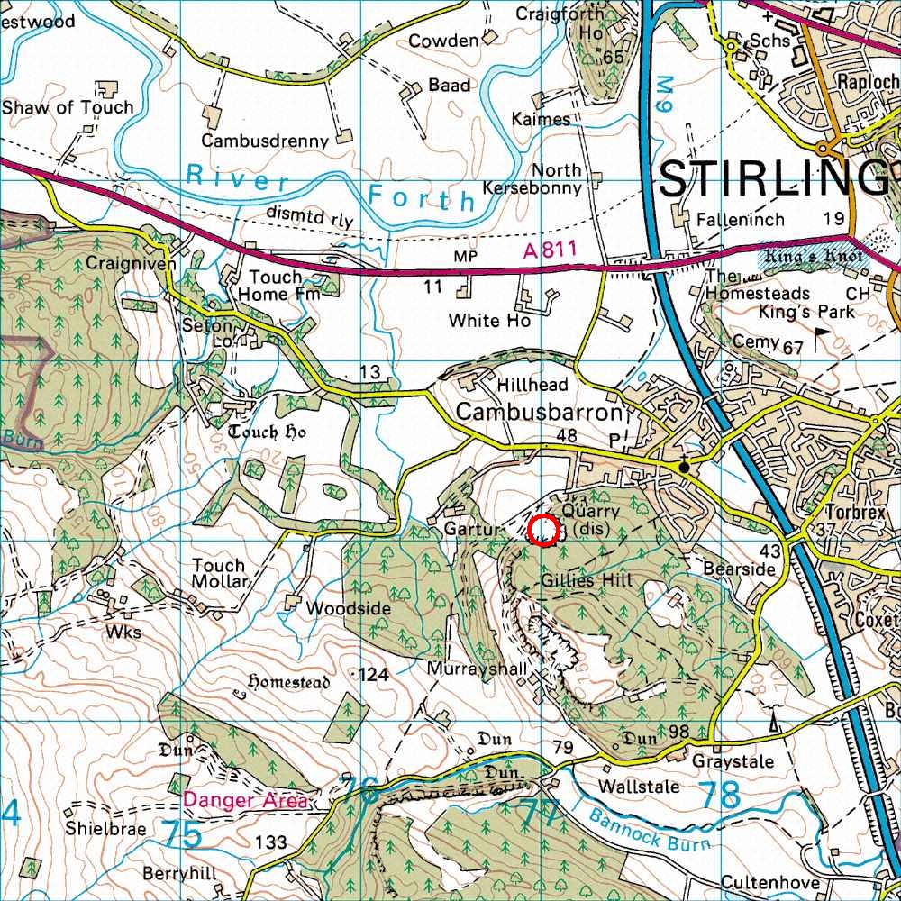
Map Ref         NS 769 920  (Landranger 57)
Lat/Long        56.105688, -3.979325
Distance        40 miles; 50 mins     (from the centre of Edinburgh)
Follow the M9 to the Stirling turn-off, junction 9 (the massive junction containing the Stirling service station), then follow the A872 towards Stirling (past the Bannockburn heritage centre). On reaching the big St. Ninians roundabout (Shell petrol station on the left of the roundabout) turn left and then left again at the Lidl supermarket (signposted Cambusbarron). Follow this road past at least one mini-roundabout until you reach a mini-roundabout signposted Cambusbarron to the left. Follow this road across the motorway and then turn right. Drive through the centre of Cambusbarron village and then turn left into Quarry road, just before the end of the village (there is an obvious signpost for Quarry road on the right of the main road). Drive up Quarry road to the top of the hill, where the road turns left, and park on the right at the edge of some woods. From the parking place, walk along the main path, past a gate and some boulders. About 100 yards past a wooden sign saying lower quarry path, turn left along a narrow path into the quarry. The climbing is along the left wall - not on the massive piles of rubble opposite!
NB There are many very good E1's (and upwards) here, but apart from one quite good severe there does not seem to be anything worth doing here below E1.